
HERE THEY CAN SEE ALL THE ACTIVATIONS
IN PORTABLE THAT WE HAVE CARRIED OUT DURING YEAR 2013 BY
TEAM "L'ESMORZAR ABANS DE TOT"
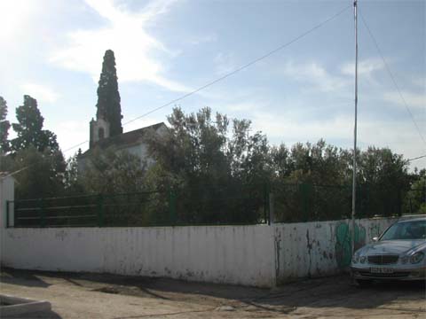
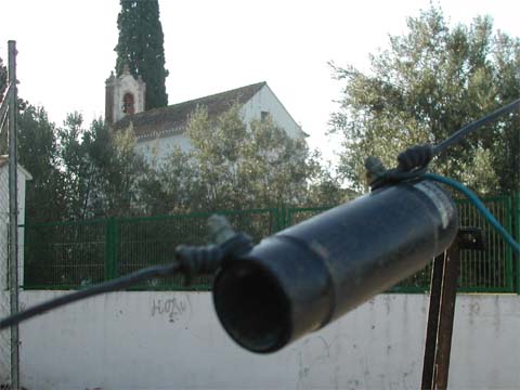
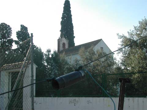
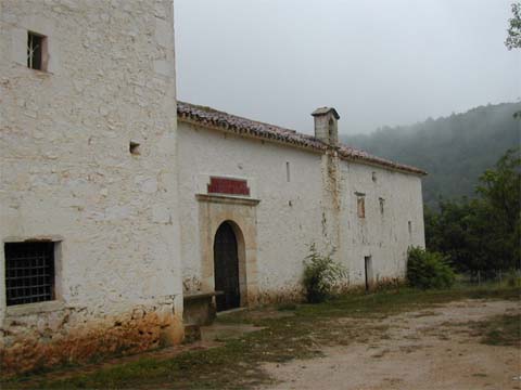
14 SEPTEMBER 2013 ACTIVITY FROM SANT ROC HERMITAGE
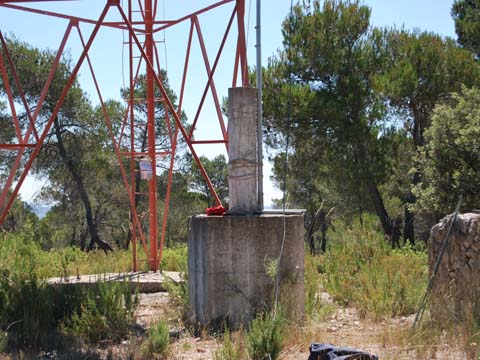
EV-426 DME:46250 CARPESA-VALENCIA
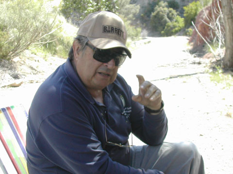
Carpesa is a district of the city of Valencia, located north of the city, in the district of North Villages. To the north, Benifaraig, Alfara del Patriarca and Vinalesa , east and Bonrepos, Mirambell and Tabernes Blanques, south to Poble Nou and west Borbotó. It was a separate municipality until 1888, when it became a district of the city of Valencia, it is situated in the hermitage of Sant Roc built in XIX century surrounded by gardens in all its entirety, we activate the this day using the callsign EA5AT / P Vicente Olmedo friend accompanying us ex EA5RC very good knowledge of Valencian cultural legacy authoring http://www.ermitascomunidadvalenciana.com web page that you can visit to see anything related to it, Here you can see some photos of the activity as well as view the log.


In the end we did in the time we were in the air a percentage of 2.6 Qsos / minute is not bad having all the conversations that have been with all our friends.
Well my friends this is it, the next more and better, we hear in the pile-up. 73

29 AUGUST 2013 ACTIVITY FROM MUNICIPALITY OF ALIAGUILLA (Cuenca)
SAN ANTONIO OF PADUA HERMITAGE ECU-022 + MVCU-0199 DME: 16014

The Aliaguilla village lies east of the province of Cuenca, next to the mountain of the same name, at an altitude of 1090 mts. above the sea. It borders the following locations: Mira, Garaballa, Talayuelas, Camporrobles and Sinarcas, the latter two in the province of Valencia.
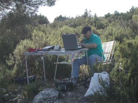
In the morning we put in the air as the first activity of the day the hermitage of San Antonio de Padua was built in the XVII century as a result of the devotion he felt for this Franciscan attributed protective powers that domestic cattle and pigs and on couples in love. Located near the town on the road to Loberuela, using the callsign EA5AT / 4 had a good temperature 15 degrees Celsius from 10 am to 12 pm rainfall suffer having to follow the activity from inside the car you can see below some pictures of the activity and the hermitage, as well as view the log.


After the activity we undertook road to La Cañada de Mira (Cuenca) where we expected a lamb stew below you can see how it turned out after finishing the cauldron with the succulent materials.

No illusions you see as though so not left him "no nothing" and yet we ate fried eggs with "fried potatoes and peppers", go fabric .... so we will lose weight ....
29 AUGUST 2013 ACTIVITY FROM MUNICIPALITY OF CARDENETE (Cuenca)
CASTLE AND FORTRESS OF CARDENETE CCU-015 + MVCU-0338 DME: 16056

The people of Cardenete Cuenca Province, is located halfway between the regions of the Middle Mountainous and Highlands Campichuelo with Baja, at an altitude of 966 meters above sea level. Cardenete is located 65 kilometers from the city of Cuenca.
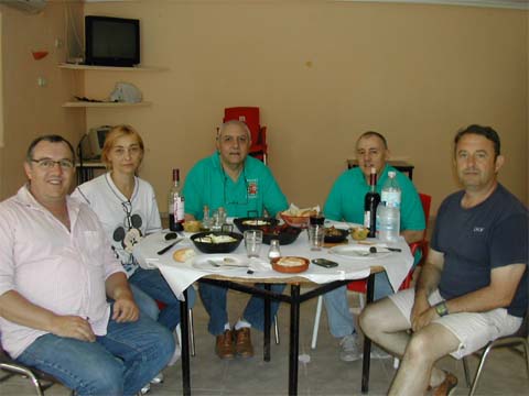
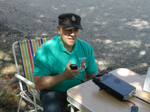
After the nice meal in the company of the family of Jose Maria EA5MB way we got our second activity, misjudge the distance I thought it was closer look but hey we valuable for other places that had it not been for this our hobby could not know, we put in the air Cardenete Castle and Fortress built by Andres Cabrera was the first Marques de Moya in XVI century referenced as CCU-015 MVCU-0338 with DME: 16056 Cardenete using the callsign EA5MB /4 not much cost us the location because access is very good to go with car, cool weather started about 16 degrees Celsius but as to wind the feeling was less, the average time to start we fell the "flood" having to terminate the activity, in the time we were in the air make 195 qsos with a percentage of 4.4 qsos / minute which is not bad given the pile-up that we had and NO call "by district" giving the opportunity to everyone, the spread was fabulous, below you can see some photos of the activity, as well as view the log.


So you can see what we fell over like staying here you have the poster for the activity, we hear in the next it will not take long, thank you very much to everyone for being on the other side and make us have a great time.
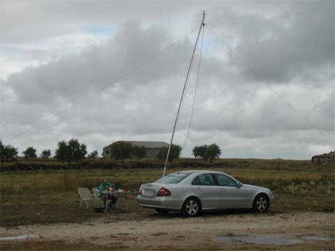
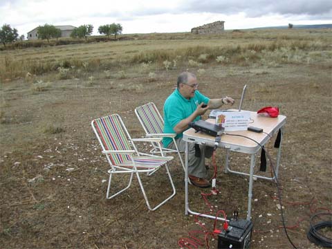
6 JULY 2013 ACTIVITY FROM MUNICIPALITY OF MIRA (Cuenca) DME: 16126

The town of Mira is located in the foothills of a mountain slope, in the region of the Serrania de Cuenca Baja, on the border with the province of Valencia. After several inquiries about the situation of geodesic points in La Cañada de Mira (Cuenca) we got down to work to put on air on this occasion were referenced as VGCU-170 and VGCU-173 located within walking distance of the house brother of Jose Maria EA5MB, this time we use the callsign EA5MB/4 Here you can see some pictures of the activity.
We started with the 1st activity of the day for the first time activating geodesic vertex VGCU-170 Labajo Blanco after we move the whole field of Iñaki brother Jose Maria, we started a little late but you know the motto of our Team "L'Esmorzar abans de Tot "or what is the same lunch before anything else, we had a good spread and the pile-up was continuous throughout the activity.


After cool off a beer on the premises where the food we had commissioned, tested first pig's tail, I was pleasantly surprised by the way, you see the menu seemed chosen for a regiment but hey, we took long enough to end all inclusive herbal marc, we had a very enjoyable meal in the company of our hosts know the terrain as Iñaki with his wife and Angel local physician, without them it would have been possible to carry out the activities, at the end we said not be the last time we thought we would see again as the heat loosen, from here I want to give thanks very expressive.

Continue after the hearty meal with the 2nd activity on this occasion the vertex geodesic referenced as VGCU-173 Cabezuela, being assisted by Iñaki's brother Jose Maria EA5MB that took us your road to where we continued the ascent on foot loaded with all the stuff for the activation, without their help we would not have been able to air this vertex, we had an excellent spread having a pile up continued until the cessation of our transmission.


We decided to make this first double activity this year 2013 to the memory of our friend Paco EA5AEN recently passed away and regular unconditional in all activities carried out by the group, requesting the special callsign ED5AEN as a tribute to his person, always will be remembered with affection between us all, we know you're where you're always us help passing the rigorous 59 R.I.P.

25 MAY 2013 ACTIVITY FROM MUNICIPALITY OF LOSA DEL OBISPO
DME: 46149

LOSA DEL OBISPO village is built
next to a ravine and its streets are quite plain.
Its grounds are generally of the Cretaceous and Jurassic limestone nature. The
relief is mountainous, with heights exceeding 600 m (cerro de Talayuela, Peña
Roya and the mountaines of Cruz and Suertes) in the Northwest half. The other
half is less rugged and has the form of a glacis inclined toward the Southeast,
with an average altitude between 400 and 350 m, which extend the agricultural
land. From North to South are the ravines of Pilatos, Tarragon and the Cava,
whose origin is the source of Santa Maria. All are temporary regime and flow
into the river Turia.
We were located in a park of this beautiful town, where we were accompanied by several local inquiring children due to our activity, who knows if will come of all this some amateur radio more in the future, here you can see some pictures of the activity in had a few endearing moments by all signs of support received from our correspondents on the initiative of the tribute to our friend Paco EA5AEN recently deceased.


Apart from lunch that we had a good lunch, we decided to stay to eat in Losa del Obispo House Anselmo restaurant, excellent Grill and perfect service in which we enjoyed good inlay in the area as well as the Lamb Chops with a good "all i oli" that although it did not come to be that are constumbrados to enjoy from the hands of José Maria EA5MB but it was quite well.


If you want to see the photographs of the activity you can do it in the video who has composed with Jean Marie EA5HE photos, as well as consult the activity log.
|
 |
25 MAY 2013 ACTIVITY FROM MUNICIPALITY OF DOMEÑO
DME: 46114 + CV-050 DOMEÑO CASTLE

The term of DOMEÑO is physically divided
into two parts: Domeño old, broader term, is where it was originally
the town, and a small area around the current town, surrounded entirely by the
municipality of Liria.
Domeño old is situated on the banks of the headwaters of the reservoir
of Loriguilla.
The term surface is very hilly, with heights exceeding 1000 m as the Umbria
black (1.045 m.). geodesic vertices of third order of Marioneta (740 m), Bosque
(584 m), Infante (652 m) and Garrama (385 m) stand out.
The Turia River enters the term by West and released him near the village the
river of Chelva. The town is surrounded by two rivers that converge at the foot
of the mountain by whose fault the town develops. Drain the territory the ravines
Lobo, the Diablos, the Cueva de la Mora and Marta.
After the delicious meal in Losa del Obispo undertook Domeño Castle path for the activity we had announced, after about 12 Kms. and a last stretch of road in quite a bad state came to Castle Domeño, being very close to the same, there are some stunning views from the top of the Castle as you can see from the pictures.


Well my friends it has been everything in this our first output of this year 2013 we expect others to do more, I don't want to dismiss me without thanking all those who called us, they encouraged, they congratulated the logs will be sent to the various managers of DME and DCE 1.0 diplomas to be credited to all the followers of the diplomas in these activities, as always, don't we send the QSL your, all the qsls will be sent via URE without any problem, we hear in the pile-up.
If you want to see the photographs of the activity you can do it in the video who has composed with Jean Marie EA5HE photos, as well as consult the activity log.
|
|

EA5AT 2013